Aerial observation is the visual surveillance and interpretation of an oil spill. SEAPRO uses a trained observer in conjunction with a small unmanned aerial system (drone) to recognize and capture many features and details of spilled oil on water and along coastlines. Photography and video are used by the observer to record the location, nature and appearance of the oil.
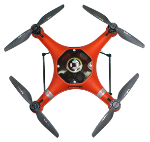
The drone is waterproof with a 4K camera and payload release capability for search and rescue assistance. The camera has low-light camera capability and can be equipped with IR/FLIR camera technology. It is an all-purpose, all-weather, waterproof flying platform.
Manufacture(s)
SwellPro Technology Co., Ltd.
Model
SplashDrone 3+
Camera
4K
Flt Time per/battery
20 min.
Range
Line of Sight
Wind Limit
Wave Limit
Weather Limit
Operator
18 mph
3 ft.
All weather (rain/snow)
Licensed pilot required
C-130
DC-6
DC-3
737
Beaver
Otter
Cessna 206
Cessna 185
Heli
Barge
Tug (only)
Lrg F/V
Sml F/V
P/U

Zone 1
Ketchikan
55°23'47.94"N 131°43'45.85"W
Zone 2
Craig
55°29'18.28"N 133°08'24.67"W
Zone 3
Petersburg
56°48'28.84"N 132°58'13.91"W
Wrangell
56°28'14.69"N 132°23'06.98"W
Zone 4
Kake
56°58'21.84"N 133°56'26.67"W
Zone 5
Sitka
57°06'53.48"N 135°23'31.89"W
Zone 6
Gustavus
58°25'21.35"N 135°42'42.36"W
Pelican
57°57'27.84"N 136°13'32.69"W
Zone 7
Juneau
58°17'26.76"N 134°23'33.26"W
Zone 8
Haines
59°14'08.76"N 135°27'51.73"W
Skagway
59°27'09.90"N 135°19'20.26"W
Zone 9
Yakutat
59°32'46.34"N 139°44'05.36"W
(1)
SEAPRO Office